Bomen soorten op deze website:
Tree species on this website:
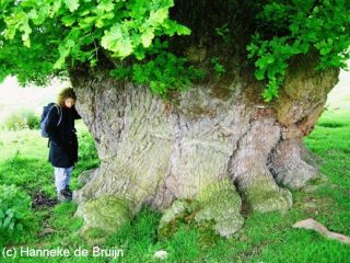
© Hanneke de Bruijn.
Eik.
Oak.
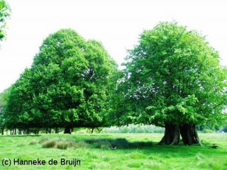
© Hanneke de Bruijn.
Linde.
Lime.
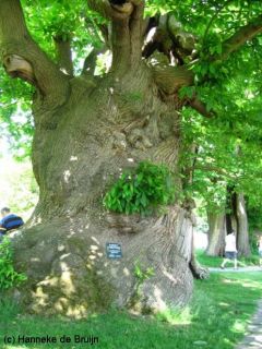
© Hanneke de Bruijn.
Tamme Kastanje.
Sweet Chestnut.
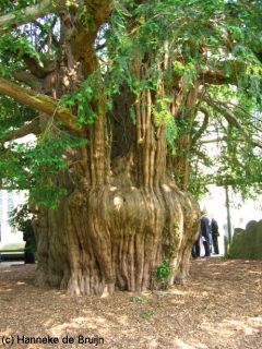
© Hanneke de Bruijn.
Taxus.
Yew.
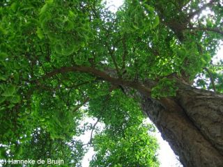
© Hanneke de Bruijn.
Ginkgo.
Maidenhair.
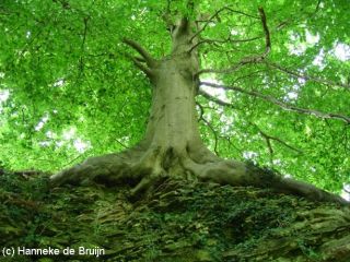
© Hanneke de Bruijn.
Beuk.
Beech.
|
Op internet heb ik de Ordnance Survey map gevonden: Ordnance Survey Maps
De Google maps kaart: Google Maps.
De subwebsite van The Woodland Trust: Ancient Tree Hunt
Laat iets achter, als je wilt.Email
Leave a message behind, if you please.Email
Tabel met bomen van de Ancient tree hunt (met GPS)
Trees in County Herefordshire (Via ancient tree hunt-woodland trust)
Ancient trees in County Herefordshire (via Woodland Trust- Ancient tree-hunt)
|
Image |
Tree |
Girth |
Grid Reference |
GPS |
Place |
|

|
Com Ash |
8.10 |
SO33304565 |
+52° 6' 18.30",
-2° 58' 34.55" |
Bredwardine, Herefordshire Private - not visible from public access (permission required to view) |
|

|
Com Yew |
9.60 |
SO23974154 |
+52° 4' 2.11",
-3° 6' 38.35" |
Cusop, Hy on Wye, Public - open access (2st) |
|

|
Com Yew |
9.50 |
SO34503850 |
+52° 2' 29.63",
-2° 57' 22.79"
|
Peterchurch, Public - open access |
|

|
Common Yew |
7.82 |
SO40404639 |
+52° 6' 52.74",
-2° 52' 20.29" |
Yazor,Public - open access |
|

|
Common Yew |
7.39 |
SO47006480 |
+52° 16'43.84",
-2° 46' 43.57"
|
Yarpole,Public - open access(Oak, further up the road) |
|

|
Common Yew |
7.76 |
SO47904455 |
+52° 5' 48.12",
-2° 45' 40.30"
|
Burghill,Public - open access |
|

|
Common Yew |
8.05 |
SO51862841 |
+51° 57' 9.73",
-2° 42' 7.95" |
Llandinabo
Hereford, Public - open access
|
|

|
Common Yew |
9.52 |
SO65703269 |
+51° 59'31.69",
-2° 30' 2.52"
|
Much Marcle, Public - open access |
|

|
Com Yew |
9.86 |
SO66002534 |
+51° 55'33.01",
-2° 29' 46.29" |
Linton, Public - open access |
|
Image |
Tree |
Girth |
Grid Reference |
GPS |
Place |
|
Com Yew |
8.23 |
SO66304090 |
+52° 4' 6.72",
-2° 29' 7.13" |
Munsley,Public - open access |
|
Common Yew |
7.98 |
SO73004189 |
+52° 4' 33.02",
-2° 23' 34.04" |
Colwall,Private - no access information recorded |
|

|
Oak |
8.05 |
SO33184291 |
+52° 4' 42.33",
-2° 58' 47.69" |
Lillapool wood, Private - visible from public access (permission not required to view) |
|

|
Oak |
7.56 |
SO3440654739 |
+52° 11' 11.58",
-2° 57' 45.04" |
Holme Marsh,Private - not visible from public access (permission required to view) |
|

|
Oak |
9.19 |
SO37755092 |
+52° 9' 4.08",
-2° 54' 45.28" |
Sarnesfield,Private - visible from public access |
|

|
Oak |
8.00 |
SO41066277 |
+52° 15'25.46",
-2° 52' 21.45" |
Easthampton,Private - visible from public access |
|

|
Sessile Oak |
10.25 |
SO40876297 |
+52° 15'39.93",
-2° 52' 32.57" |
Easthampton,Public - partial access |
|
|
Penduculate oak |
6.28 |
SO4020062500
|
+52° 15'30.10",
-2° 52' 43.08"
|
Easthampton, Private - no access information recorded |
|

|
Oak |
8.04 |
SO42285821 |
+52° 13'12.16",
-2° 50' 53.08" |
Eardisland, Leominster Private - visible from public access. 5-700 yrs old |
|

|
Oak |
8.00 |
SO43976578 |
+52° 17' 8.13",
–2° 47' 31.00" |
Croft Castle Park , Public - restricted access (e.g. National Trust property(100th of trees) |
|

|
Oak |
7.00 |
SO44026594 |
+52° 17' 8.13",
-2° 47' 31.00" |
Croft Castle & Parkland |
|

|
Oak |
7.80 |
SO44096578 |
+52° 17' 8.13",
-2° 47' 31.00" |
Croft Castle & Parkland |
|
Image |
Tree |
Girth |
Grid Reference |
GPS |
Place |
|

|
Oak |
8.00 |
SO44116599 |
+52° 17' 8.13",
-2° 47' 31.00" |
Croft Castle & Parkland |
|

|
Oak |
7.00 |
SO44136603 |
+52° 17' 8.13",
-2° 47' 31.00" |
Croft Castle & Parkland |
|

|
Oak |
8.00 |
SO44136610 |
+52° 17' 8.13",
-2° 47' 31.00" |
Croft Castle & Parkland |
|
Oak |
7.00 |
SO44156602 |
+52° 17' 8.13",
-2° 47' 31.00" |
Croft Castle & Parkland |
|

|
Oak |
7.50 |
SO44276584 |
+52° 17' 8.13",
-2° 47' 31.00" |
Croft Castle & Parkland |
|

|
Oak |
7.28 |
SO44296584 |
+52° 17' 8.13",
-2° 47' 31.00" |
Croft Castle & Parkland |
|
Oak |
9.00 |
SO44696624 |
+52° 17' 8.13",
-2° 47' 31.00" |
Croft Castle & Parkland |
|

|
Oak |
7.60 |
SO45036580 |
+52° 17' 8.13",
-2° 47' 31.00" |
Croft Castle & Parkland |
|

|
Pedunculate Oak |
7.20 |
SO43886595 |
+52° 17' 8.13",
-2° 47' 31.00" |
Croft Castle & Parkland |
|

|
Pedunculate Oak |
7.10 |
SO44486585 |
+52° 17' 8.13",
-2° 47' 31.00" |
Croft Castle & Parkland |
|

|
Pedunculate Oak |
8.50 |
SO45156502 |
+52° 17' 8.13",
-2° 47' 31.00" |
Croft Castle & Parkland (near end exit) |
|

|
Sessile Oak |
7.63 |
SO44126579 |
+52° 17' 8.13",
-2° 47' 31.00" |
Croft Castle & Parkland |
|

|
Sessile Oak |
7.53 |
SO44276585 |
+52° 17' 8.13",
-2° 47' 31.00" |
Croft Castle & Parkland |
|

|
Sessile Oak |
8.07 |
SO44616679 |
+52° 17' 8.13",
-2° 47' 31.00" |
Croft Castle & Parkland |
|
Sessile Oak |
8.01 |
SO44626624 |
+52° 17' 8.13",
-2° 47' 31.00" |
Croft Castle & Parkland |
|

|
Sessile Oak |
9.20 |
SO44686533 |
+52° 17' 8.13",
-2° 47' 31.00" |
Croft Castle & Parkland |
|
Sessile Oak |
7.85 |
SO44716629 |
+52° 17' 8.13",
-2° 47' 31.00" |
Croft Castle & Parkland |
|

|
Sessile Oak |
10.97 |
SO44746533 |
+52° 17' 8.13",
-2° 47' 31.00" |
Croft Castle & Parkland |
|

|
Sessile Oak |
7.66 |
SO44786640 |
+52° 17' 8.13",
-2° 47' 31.00" |
Croft Castle & Parkland |
|

|
Sessile Oak |
8.60 |
SO44796550 |
+52° 17' 8.13",
-2° 47' 31.00" |
Croft Castle & Parkland |
|

|
Sessile Oak |
8.55 |
SO44806549 |
+52° 17' 8.13",
-2° 47' 31.00" |
Croft Castle & Parkland |
|

|
Sessile Oak |
8.32 |
SO45026584 |
+52° 17' 8.13",
-2° 47' 31.00" |
Croft Castle & Parkland |
|

|
Sessile Oak |
7.60 |
SO45036580 |
+52° 17' 8.13",
-2° 47' 31.00" |
Croft Castle & Parkland |
|

|
Sweet Chestnut |
8.58 |
SO44186530 |
+52° 17' 8.13",
-2° 47' 31.00" |
Croft Castle & Parkland |
|

|
Sweet Chestnut |
7.45 |
SO44206531 |
+52° 17' 8.13",
-2° 47' 31.00" |
Croft Castle & Parkland |
|

|
Sweet Chestnut |
7.90 |
SO44586535 |
+52° 17' 8.13",
-2° 47' 31.00" |
Croft Castle & Parkland |
|

|
Sweet Chestnut |
7.12 |
SO44596534 |
+52° 17' 8.13",
-2° 47' 31.00" |
Croft Castle & Parkland |
|

|
Sweet Chestnut |
9.00 |
SO44646595 |
+52° 17' 8.13",
-2° 47' 31.00" |
Croft Castle & Parkland |
|

|
Sweet Chestnut |
9.28 |
SO44676533 |
+52° 17' 8.13",
-2° 47' 31.00" |
Croft Castle & Parkland |
|

|
Sweet Chestnut |
9.28 |
SO44676533 |
+52° 17' 8.13",
-2° 47' 31.00" |
Croft Castle & Parkland |
|

|
Sweet Chestnut |
7.64 |
SO44706554 |
+52° 17' 8.13",
-2° 47' 31.00" |
Croft Castle & Parkland |
|

|
Sweet Chestnut |
7.39 |
SO44706561 |
+52° 17' 8.13",
-2° 47' 31.00" |
Croft Castle & Parkland |
|

|
Oak |
9.21 |
SO47896596 |
+52° 17' 6.05",
–2° 45' 58.30" |
Bircher, Private - visible from public access. Very ancient Oak situated in Cow Pasture field at Gate House Farm, Bircher. Have picture of field from 1920s and recent of field and tree. |
|

|
Pedunculate Oak |
7.63 |
SO47936592 |
+52° 17' 6.05",
–2° 45' 58.30" |
Bircher, Private - visible from public access |
|

|
Oak and beech |
7.70 |
SO75493623 |
Oak +52° 1' 38.31", -2° 20' 49.42"
Beech +52° 1' 15.68", -2° 21' 4.18" |
Malvern Hills Hollybush, Private - visible from public access, Local/historic name White leaved Oak |
|
Image |
Tree |
Girth |
Grid Reference |
GPS |
Place |
|

|
Pedunculate Oak |
9.17 |
SO2990049700 |
+52° 8' 27.20",
-3° 1' 34.54" |
Lower Welson,Public - partial access, Great Oak, Eardisley Oak |
|

|
Pedunculate Oak |
7.25 |
SO31625905 |
+52° 13'23.23",
-2° 59' 56.59" |
Titley, Private - not visible from public access (permission required to view) |
|

|
Sweet Chestnut |
7.30 |
SO31715913 |
+52° 13'23.23",
-2° 59' 56.59" |
Titley, Private - not visible from public access (permission required to view) |
|

|
Pedunculate Oak |
8.32 |
SO34273616 |
+52° 1' 1.61",
-2°7'31.06" |
Turnastone,Private - visible from public access |
|

|
Pedunculate Oak |
9.60 |
SO36264348 |
+52° 5' 14.80",
-2° 56' 6.08" |
Monnington on Wye, Private - not visible from public access (permission required to view) |
|
Pedunculate Oak |
11.37 |
SO4290025600 |
+51° 55'38.44",
-2° 50' 31.60" |
Kentchurch, Private - no access information recorded, Jack Kemp's Oak, Jack of Kent's Oak |
|

|
Pedunculate Oak |
9.75 |
SO55293478 |
+52° 0' 39.55",
-2° 39' 2.86" |
Holme Lacy, the house. Public - partial access (4st) |
|

|
Sessile Oak |
9.25 |
SO55223445 |
+52° 0' 39.55",
-2° 39' 2.86" |
Holme Lacy |
|
Pedunculate Oak |
7.00 |
SO60733386 |
+52° 0' 6.83",
-2° 34' 30.95" |
Lower Buckenhill, Fownhope, Private - visible from public access |
|

|
Pedunculate Oak |
7.55 |
SO62405962 |
+52° 14' 0.14",
-2° 33' 17.18" |
Thornbury (3st), Public - partial access |
|

|
Pedunculate Oak |
8.10 |
SO72063770 |
+52° 2' 8.53",
-2° 24' 48.97" |
Ledbury, Public - partial access |
|

|
Pedunculate Oak |
7.59 |
SO74113589 |
+52° 1' 10.16",
-2° 23' 9.78" |
Eastnor,Public - partial access (3st) |
|

|
Sessile Oak |
8.65 |
SO35707123 |
+52° 20' 29.40",
-2° 56' 14.89" |
Brampton Bryan. Park (5st), Private - This site is NOT open to public.Leave Brampton Bryan Parish Hall and pass through Brampton Bryan Park |
|
Small leaved Lime |
7.10 |
SO35607180 |
+52° 20' 29.40",
-2° 56' 14.89" |
on the public bridleway passing 3 Ponds and Park Cottage on your right then we left the public path and branched off to our right and climbed quit steeply. |
|

|
Sweet Chestnut |
7.58 |
SO35777125 |
+52° 20' 29.40",
-2° 56' 14.89" |
Brampton Bryan park,is an extensive former deer park |
|

|
Sweet Chestnut |
7.65 |
SO35797126 |
+52° 20' 29.40",
-2° 56' 14.89" |
with lines and groves of trees. Within the park |
|

|
Sweet Chestnut |
7.10 |
SO35807126 |
+52° 20' 29.40",
-2° 56' 14.89" |
is the outline of an early 18th-century formal garden, |
|

|
Sweet Chestnut |
8.25 |
SO35857126 |
+52° 20' 29.40",
-2° 56' 14.89" |
including terraced lawns and a chain of ponds. |
|

|
Sweet Chestnut |
8.78 |
SO35857134 |
+52° 20' 29.40",
-2° 56' 14.89" |
Brampton Bryan, The park is first shown on a map of 1577, |
|

|
Sweet Chestnut |
8.20 |
SO35877126 |
+52° 20' 29.40",
-2° 56' 14.89" |
Brampton Bryan Park,but may be of older origin. |
|

|
Sweet Chestnut |
9.02 |
SO35877136 |
+52° 20' 29.40",
-2° 56' 14.89" |
The formal garden appears to be of the early 18th century. |
|

|
Sweet Chestnut |
7.75 |
SO35887126 |
+52° 20' 29.40",
-2° 56' 14.89" |
Brampton Bryan Park, The park lies on a ridge known as Pedwardine Hill, |
|

|
Sweet Chestnut |
9.38 |
SO35897138 |
+52° 20' 29.40",
-2° 56' 14.89" |
which at its highest point is over 300 metres (1000 feet) above sea level. |
|

|
Sweet Chestnut |
7.05 |
SO35907139 |
+52° 20' 29.40",
-2° 56' 14.89" |
The ridge and western part of the Park is composed of
mildly calcareous Upper Silurian Rocks, |
|

|
Sweet Chestnut |
7.92 |
SO35917125 |
+52° 20' 29.40",
-2° 56' 14.89" |
the central portion of the Brampton Bryan Park lies on Wenlock
shales |
|

|
Sweet Chestnut |
8.30 |
SO35937143 |
+52° 20' 29.40",
-2° 56' 14.89" |
whilst the extreme eastern edge of the site overlies |
|

|
Sweet Chestnut |
7.35 |
SO35947144 |
+52° 20' 29.40",
-2° 56' 14.89" |
Precambrian rocks. The bedrock
is overlain |
|

|
Sweet Chestnut |
7.03 |
SO35957145 |
+52° 20' 29.40",
-2° 56' 14.89" |
by drift material and the soils are acidic in character. |
|

|
Sweet Chestnut |
7.73 |
SO35967147 |
+52° 20' 29.40",
-2° 56' 14.89" |
Brampton Bryan park, The site has been selected (SSSI) Site of Special Scientific Intrest because of its national importance |
|

|
Sweet Chestnut |
7.75 |
SO35977151 |
+52° 20' 29.40",
-2° 56' 14.89" |
as a wood pasture, ranking
alongside sites |
|

|
Sweet Chestnut |
8.92 |
SO35987152 |
+52° 20' 29.40",
-2° 56' 14.89" |
,such as the New Forest, Windsor Great Park, Sherwood Forest and Moccas Park. |
|

|
Sweet Chestnut |
7.75 |
SO36017159 |
+52° 20' 29.40",
-2° 56' 14.89" |
Brampton Bryan park, Associated with this are important communities of lichens and invertebrates. |
|

|
Sweet Chestnut |
7.77 |
SO36127173 |
+52° 20' 29.40",
-2° 56' 14.89" |
Brampton Bryan park |
|
Sweet Chestnut |
7.08 |
SO36127174 |
+52° 20' 29.40",
-2° 56' 14.89" |
Brampton Bryan park |
|

|
Sweet Chestnut |
9.27 |
SO36137172 |
+52° 20' 29.40",
-2° 56' 14.89" |
Brampton Bryan park |
|

|
Sessile Oak |
7.50 |
SO48986666 |
+52° 17' 45.65",
-2° 44' 56.97" |
Orleton, Private - visible from public access |
|

|
Sessile Oak |
7.20 |
SO56475970 |
+52° 14' 2.41",
-2° 38' 19.29" |
Pudleston , Private - visible from public access |
|

|
Sessile Oak |
7.80 |
SO56475974 |
+52° 14' 2.41",
-2° 38' 19.29" |
Pudleston , Private - visible from public access |
|

|
Sessile Oak |
9.28 |
SO64506010 |
+52° 14' 20.39",
-2° 31' 0.84" |
Collington (2st, 1near the road), Public - partial access |
![]() |
![]() |
Mijn eigengemaakte bomenboekje (professioneel gedrukt fotoboek bedrijf).
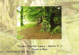
De voorkant van mijn boekje.
© Hanneke de Bruijn.
Een kijkje in het boekje 24 pagin's(14,5 x 10,5 cm).
Taxus bomenboekje 24 pagina's (A5, 20 x 15 cm) Only in English:
Heeft u interesse in het boekje, neem dan gerust contact met mij op. Email
|
The creator:
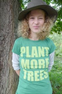
Hanneke '08.
I got One of this T-shirt for sale (XL) €20
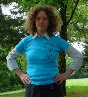
Hanneke '09.(Met speciaal ontworpen Girlie T-shirt aan, met een boom en de tekst: Plant More Trees. With special disign Girlie T-shirt. A Tree and a tekst: Plant More Trees.)
© Hanneke de Bruijn.

Girlie Achterkant/backside
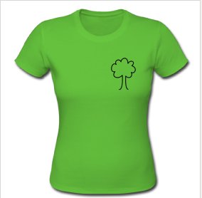
Girlie Voorkant/front (Ander T-shirt)

Girlie Achterkant/backside: Tekst: Het is een uitdaging om bomen te behouden.
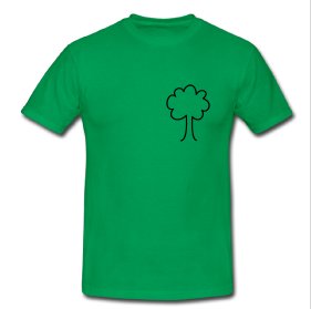
Heren Shirt Voorkant

Heren Shirt Achterkant (Text: Het is een uidaging om bomen te behouden)
Deze T-shirts (Dames Girlie-shirt & Heren-shirt klassiek. Klassiek gesneden, nauwsluitend Girlie & Heren shirt met fijngewoven stof van 100% katoen met een hoge stofdichtheid van 220g/m˛.) zijn speciaal ontworpen door Henk van Boeschoten. Te bestellen (in alle maten en kleuren) op deze website: indecirkel.spreadshirt.nl
This T-shirts (Ladies Girlie-shirt & Men-shirts Classic. Classis snit, close-fitting with fine woven 100% cotton fabric. The density of the fabric is 220g/m˛.) are special designed by Henk van Boeschoten. You can order it (in all sizes and colours) on this website: indecirkel.spreadshirt.nl
Mijn andere passie is: Marillion
Marillion's laatste album is verkrijgbaar in de winkel en op deze website:www.marillion.com
mypassionfortrees.nl © 2008 - 2012• Privacy Policy • Terms Of Use | |